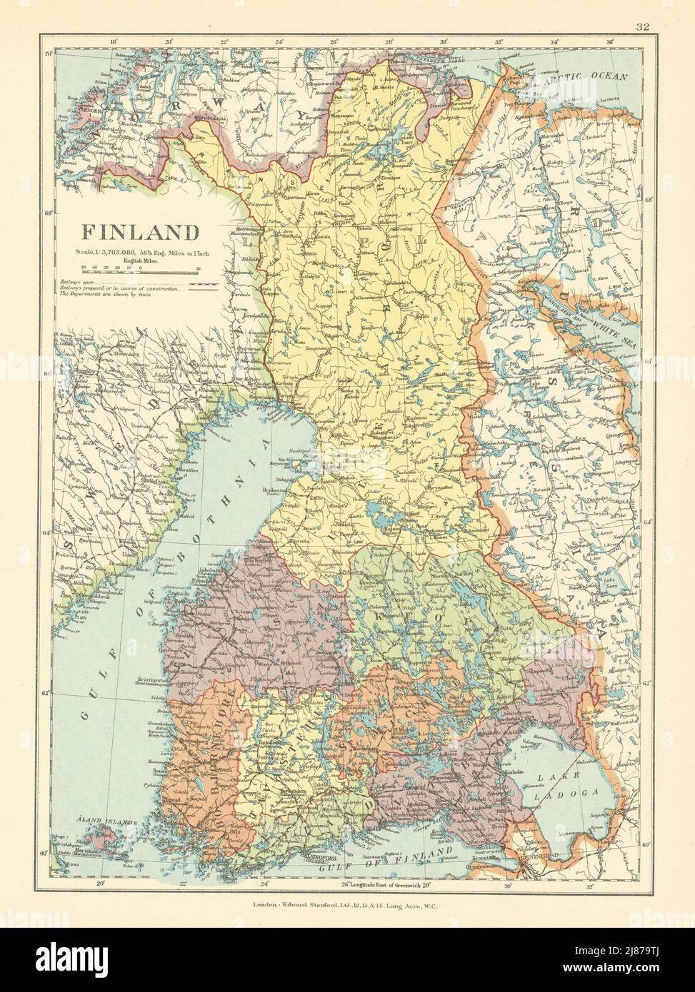
Finland. Pre WW2 borders with Russia. Gulf of Bothnia. STANFORD c1925 old map
RFID:Image ID:2J879TJ
Image details
Contributor:
Antiqua Print Gallery / Alamy Stock PhotoImage ID:
2J879TJFile size:
36.7 MB (2.9 MB Compressed download)Releases:
Model - no | Property - noDo I need a release?Dimensions:
3100 x 4140 px | 26.2 x 35.1 cm | 10.3 x 13.8 inches | 300dpiDate taken:
1925Location:
FinlandMore information:
This image could have imperfections as it’s either historical or reportage.
Finland. Artist/engraver/cartographer: Edward Stanford Ltd. Provenance: "Stanford's London Atlas of Universal Geography, 'Whitehall' Edition", London: Edward Stanford Ltd. 12, 13 & 14 Long Acre, WC2, and Whitehall House, 29 & 30 Charing Cross, SW1. Type: Antique colour atlas map.