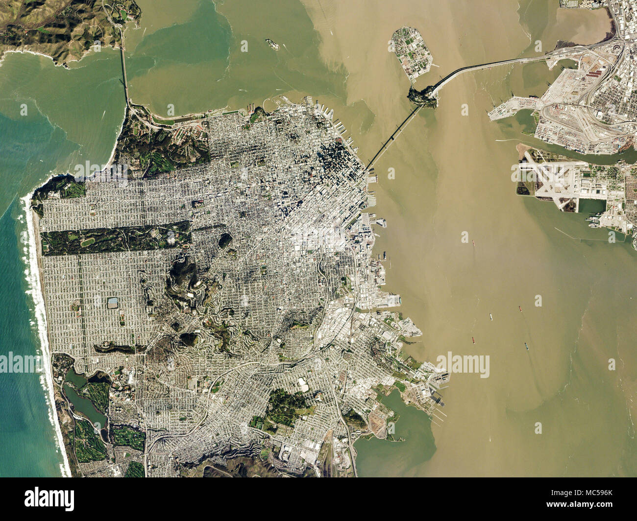
On a rare clear February day during California’s rainy 2017 winter, a satellite snapped this picture of Planet’s San Francisco headquarters. It shows not only the Golden Gate Bridge, top left, but also the sediment washed by rains from the 4,600 square miles of the watershed muddying the San Francisco Bay. A scientist measuring how water quality changes as runoff increases could supplement data from water samples with satellite imagery from the same days—since Planet re-images the entire planet every day—to develop a broader understanding of the daily impact of sediment. (Image courtesy of Pla
Image details
Contributor:
AB Forces News Collection / Alamy Stock PhotoImage ID:
MC596KFile size:
12.4 MB (1.3 MB Compressed download)Releases:
Model - no | Property - noDo I need a release?Dimensions:
2400 x 1800 px | 40.6 x 30.5 cm | 16 x 12 inches | 150dpiDate taken:
1 January 2018More information:
This image is a public domain image, which means either that copyright has expired in the image or the copyright holder has waived their copyright. Alamy charges you a fee for access to the high resolution copy of the image.
This image could have imperfections as it’s either historical or reportage.
On a rare clear February day during California’s rainy 2017 winter, a satellite snapped this picture of Planet’s San Francisco headquarters. It shows not only the Golden Gate Bridge, top left, but also the sediment washed by rains from the 4, 600 square miles of the watershed muddying the San Francisco Bay. A scientist measuring how water quality changes as runoff increases could supplement data from water samples with satellite imagery from the same days—since Planet re-images the entire planet every day—to develop a broader understanding of the daily impact of sediment. (Image courtesy of Planet)