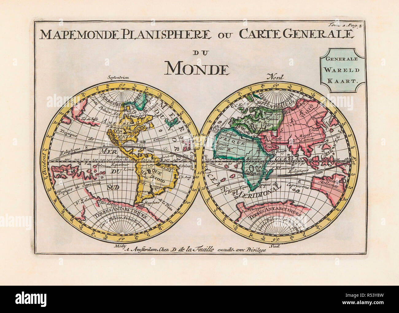
World map dating from the late 17th or early 18th century and published in Amsterdam showing the western and eastern hemispheres. Amongst many inaccuracies, the California area is shown as an island.
RMID:Image ID:R53Y8W
Image details
Contributor:
Classic Image / Alamy Stock PhotoImage ID:
R53Y8WFile size:
52.8 MB (2.4 MB Compressed download)Releases:
Model - no | Property - noDo I need a release?Dimensions:
5079 x 3636 px | 43 x 30.8 cm | 16.9 x 12.1 inches | 300dpiDate taken:
19 September 2018More information:
This image could have imperfections as it’s either historical or reportage.